Land use planning with GIS Module
GIS Module for Urban Planning and Development (GISUPD)
GISUPD the premier Geographic Information System (GIS) solution designed specifically for urban planning and development. Our platform empowers you to make smarter, data-driven decisions that shape sustainable, resilient, and livable cities. From managing land use to optimizing infrastructure and engaging with communities, GISUPD provides the tools you need to build the future.
GIS for Urban Planning & Development
GIS module, for Land use planning
is an advanced geospatial solution Hi-res satellite images
Provides layered geospatial data for informed urban planning and resource allocation.

Empower your city with data-driven decisions and connected communities.

The LAMS Platform
GIS for Urban Planning & Development
A Strategic Blueprint for Urban Planning & Development: A unified GIS platform that streamlines workflows, unlocks data-driven decisions, and fosters community engagement to build the cities of tomorrow.
Unified Data Platform
Consolidate data from multiple sources—including land records, zoning regulations, and environmental reports—into a single, secure database
Intuitive Mapping & Visualization
Use GIS to create and analyze dynamic maps and 3D models of your city for a clear, comprehensive view of every project.
Streamlined Workflows
Automate manual tasks and manage the entire development lifecycle, from feasibility analysis to approvals, to increase efficiency and speed
Enhanced Public Transparency
Build trust and reduce administrative burden with secure, online portals that provide public access to official records and project updates.
Informed Decision-Making
Leverage real-time data and analytics to make evidence-based decisions for sustainable urban growth and optimized resource allocation.
Seamless Interoperability
Break down departmental silos by integrating with your existing systems, enabling collaboration across different agencies and stakeholders.
The innovative solution developed by Innobles for the efficient and complete management of public parking space and all related activities and problems.
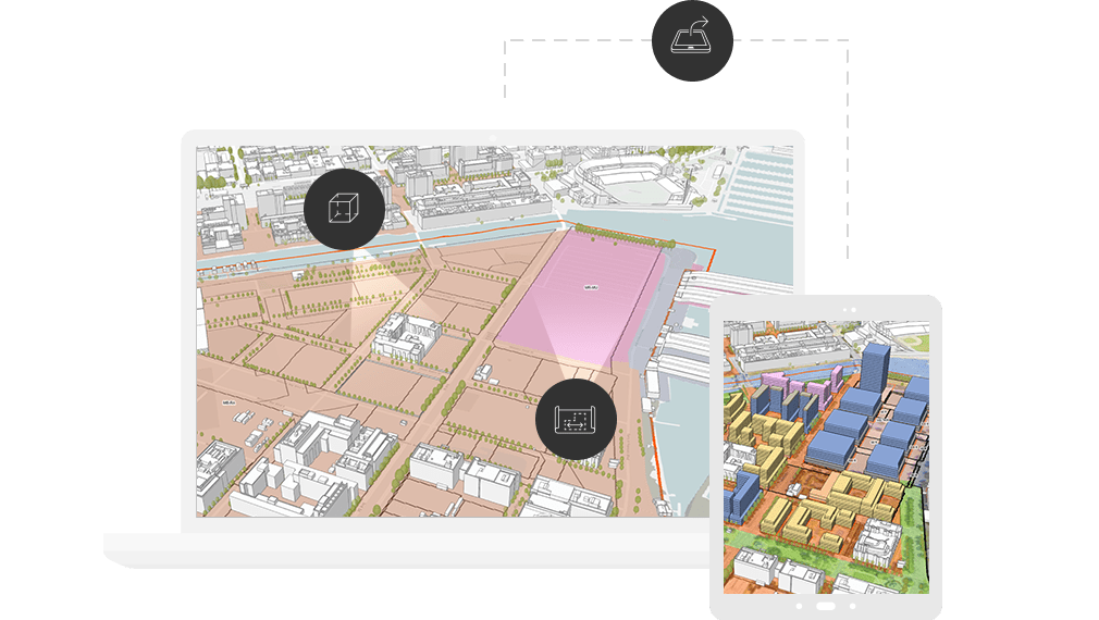


Next-Gen Urban Planning: The Innobles Advantage
- AI-Powered Feasibility Analysis: Our system uses AI models to evaluate project proposals, simulating their impact on infrastructure and the environment. This capability significantly reduces the time and manual scrutiny required for approvals.
- Interactive 3D Scenario Modeling: Visualize development scenarios within a digital twin of your city, with real-time feedback on density, zoning, and environmental impact. This helps you avoid costly oversights and misunderstandings before construction begins.
- Digital Twin & Real-Time Monitoring: Create a dynamic, digital replica of your city to monitor infrastructure and track land-use changes in real time. This provides a holistic view of your city’s structure, allowing you to plan for sustainability and disaster resilience more effectively.
- Transferable Development Rights (TDR) Management: Innobles offers a specialized module to manage the complex, market-based process of transferring development rights between protected and development areas. This provides a modern, tech-enabled framework for a sophisticated land-use management technique, which is often difficult and resource-intensive to implement.
Benefits
- Improved Decision-Making: Move from intuition to actionable intelligence. Our system provides accurate, real-time data and powerful insights, ensuring every decision is well-informed.
- Increased Efficiency & Cost Savings: Automate data collection and analysis, streamline approval processes, and optimize resource allocation to save time and reduce project costs.
- Enhanced Sustainability: Plan for a greener future by analyzing environmental factors and promoting sustainable development practices.
- Better Communication: Create clear, visual reports and interactive maps that simplify complex information, making it easy to communicate with stakeholders, officials, and the public.
- Future-Proof Your City: Prepare for population growth, climate change, and other urban challenges by using predictive modeling to build a more resilient and adaptable city.

Technical Details
- Developed as a dynamic web-based geospatial application.
- Integration with Oracle-based applications for enhanced database management.
- APDA-based tools ensuring field verification and compliance tracking.
Technical Details
- Geo-referenced maps overlayed with satellite imagery for real-time updates.
- Automation of field data capture using GPS and CAD integration.

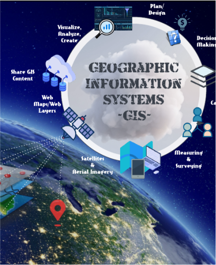
Use case
Who is GISUPD for?
- Gain a holistic view of your city to guide land-use planning, zoning, and project management.
- Improve public services, manage city assets, and ensure transparency in all development projects
- Analyze site suitability, plan for new infrastructure, and model the impact of design proposals.
- Assess environmental risks, identify conservation areas, and develop sustainable solutions for urban growth.
- Streamlined and transparent processes for land-use planning.
- Identify optimal locations for new developments by analyzing market trends, infrastructure, and demographic data.
Other CRM Modules
/LAMS
• Land Bank
• Land Acquisition
• Transfer of Development Rights (TDR)
/Project Monitoring System
Project Monitoring System offers a robust solution for managing large scale projects by providing tools for creating and maintaining project records
/eTendering System
Secure, Interactive, and Transparent Tender Lifecycle Management
/Grievance Management
streamlines complaint and feedback collection, improving government responsiveness and enhancing accountability
/Smart City Solutions
for Enhancing citizen experience and service ease
/CSR Monitoring System
Plan, manage and monitor all CSR activities easily.
/HRM
Enhanced recruitment processes
Effective people management
Optimised workforce productivity
Higher employee retention
/Inventory Management System
Innobles strengthens inbound tourism by providing innovative solutions that enhance the travel, tourism, and hospitality sectors
