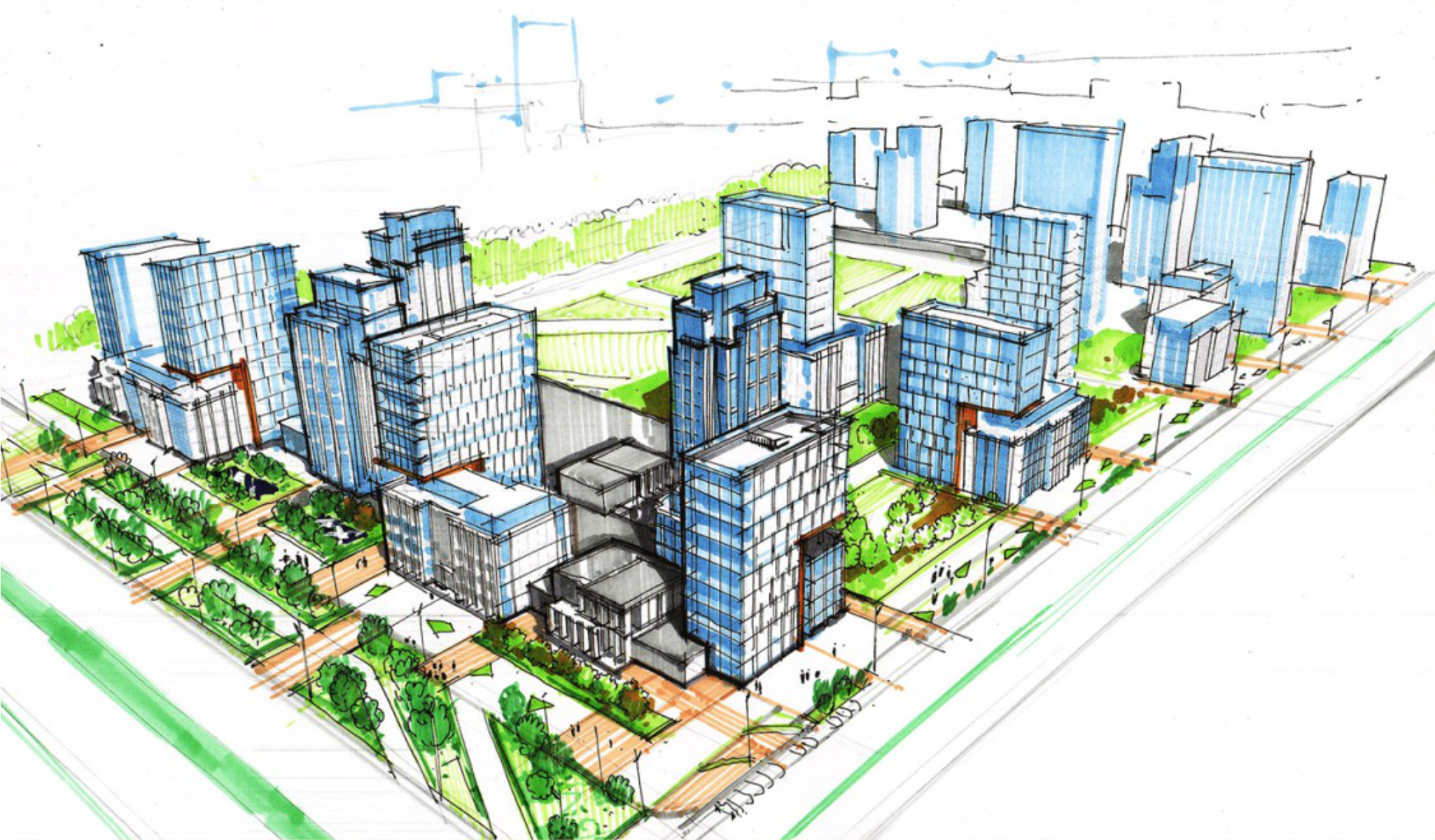
Data-Driven City Planning
Urban GIS Integration in Urban Planning
Integrating GIS into urban planning enhances efficiency, data accuracy, and decision-making, addressing modern urban challenges through spatial insights.
Unlock the Power of Procurement with our
GIS Module
for Data-DrivenTown Planning
Unlocking the Potentiality of GIS in Planning and Monitoring of Urban Areas The primary customers for the Urban GIS Integration project include local government bodies, urban planning agencies, real estate developers, and city planners who seek to enhance their planning capabilities, manage resources more effectively, and engage with communities for sustainable urban development.

The Urban GIS Integration project aims to enhance urban planning capabilities by incorporating Geographic Information System (GIS) technology.

GIS Integration for Strategic Urban Planning
A unified platform that digitizes and connects all your city data to power smarter, more sustainable urban development.
Key Offering
Unified Data Platform
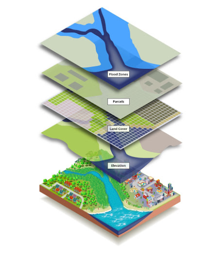
Consolidate data from multiple sources—including land use, demographics, and environmental data—into a single, centralized database for easy access and management.
Intuitive Mapping & Visualization
Create and analyze dynamic maps and 3D models of your city's structure to gain a comprehensive, holistic view of every project.
Advanced Spatial Analysis
Conduct site suitability studies and run complex spatial queries to identify ideal locations for development, assess environmental impact, and manage density.
Enhanced Decision-Making
Leverage real-time data and analytics to make smarter, more informed choices about land use, resource allocation, and infrastructure development.
Seamless Workflows & Collaboration:
Automate repetitive tasks and provide a common platform for departments and stakeholders to share and discuss data, improving efficiency and coordination.
Public Transparency & Engagement
Build public trust by offering secure, online portals that provide constituents with access to official records and project information.
The Urban GIS Integration project aims to enhance urban planning capabilities by incorporating Geographic Information System (GIS) technology. This integration supports decision-making processes through improved data collection, analysis, and visualization, aiding in town planning, road network analysis, and asset mapping.


Key Features
- Town Planning: Facilitates effective land use and development strategies.
- Road Network Analysis: Optimizes traffic flow and transportation infrastructure.
- POI Services: Identifies key locations for services like health and education.
- Asset Mapping: Visualizes and manages public and private assets efficiently.
- Basic Amenities Portal: Centralizes information on essential services and heritage sites.


Features
Salient Features
- Enhanced Decision-Making: Provides comprehensive spatial data to inform planning decisions effectively.
- Improved Efficiency: Streamlines urban planning processes with automated data collection and analysis.
- Resource Optimization: Enables efficient management and allocation of urban resources and infrastructure.
- Community Engagement: Supports transparent communication and collaboration with stakeholders and citizens.
- Sustainable Development: Promotes environmentally friendly planning by integrating ecological data.
- Comprehensive Analysis: Offers a holistic view of urban environments through detailed spatial data.
- User-Friendly Interface: Designed for ease of use by urban planners and stakeholders.
- Real-Time Data Updates: Ensures planners have access to the latest information for decision-making.
- Scalable Solutions: Adaptable to the needs of small towns or large metropolitan areas.
- Cost-Effective Implementation: Offers affordable solutions without compromising on functionality.
- Town Planning: Facilitates effective land use and development strategies.
- Road Network Analysis: Optimizes traffic flow and transportation infrastructure.
- POI Services: Identifies key locations for services like health and education.
- Asset Mapping: Visualizes and manages public and private assets efficiently.
- Basic Amenities Portal: Centralizes information on essential services and heritage sites.
- Advanced GIS Software: Utilizes the latest platforms for accurate spatial analysis.
- Cloud-Based Solutions: Ensures data accessibility and security from anywhere.
- Mobile Integration: Offers planners the ability to access data on-the-go.
- Intuitive Dashboards: Simplifies data visualization and reporting for stakeholders.
- Secure Data Management: Implements industry-leading security measures for data protection.
Other CRM Modules
/LAMS
• Land Bank
• Land Acquisition
• Transfer of Development Rights (TDR)
/Project Monitoring System
Project Monitoring System offers a robust solution for managing large scale projects by providing tools for creating and maintaining project records
/eTendering System
Secure, Interactive, and Transparent Tender Lifecycle Management
/Grievance Management
streamlines complaint and feedback collection, improving government responsiveness and enhancing accountability
/Smart City Solutions
for Enhancing citizen experience and service ease
/CSR Monitoring System
Plan, manage and monitor all CSR activities easily.
/HRM
Enhanced recruitment processes
Effective people management
Optimised workforce productivity
Higher employee retention
/Inventory Management System
Innobles strengthens inbound tourism by providing innovative solutions that enhance the travel, tourism, and hospitality sectors
