Smart Parking Systems
Land Bank, Land Acquisition & TDR System (LAMS)
LAMS by Innobles offers a comprehensive solution tailored to enhance urban redevelopment and ease of doing business (EoDB)
Efficient, Secure, and User-Friendly Smart Parking Management
Integrated Land Management
Information System Real timeTracking
LAMS is implemented to enhance the efficiency of the current land services provided by the city government.

It enables to Integrate multiple individual land management systems
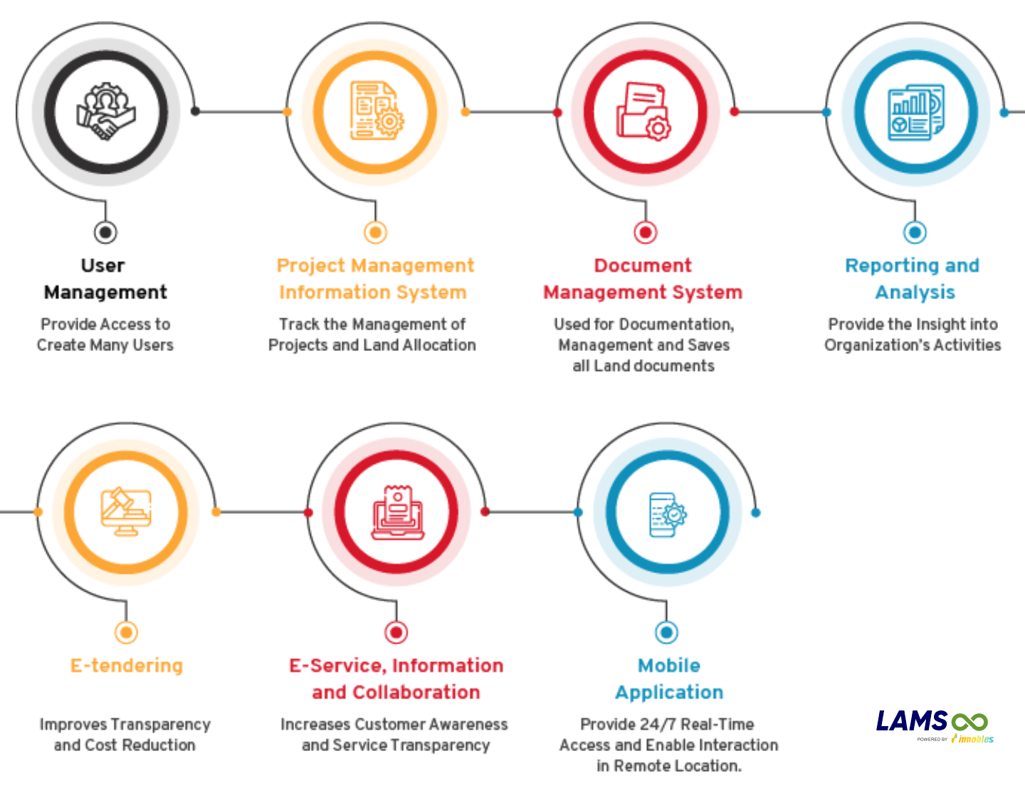
Dedicated Land Management System Software that manages all land acquisition, land allotment related activities and consolidates all land information into a single window to manage and monitor all your land assets.
LAMS is a web and mobile-based business solution that acts as a central repository of all Land information, data & documents, making it accessible anytime anywhere.



Features
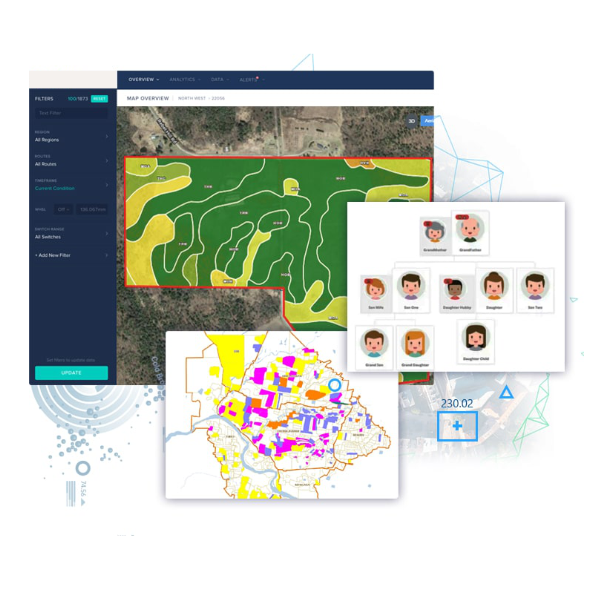
- Plot Map Visualisation
- Land Acquisition Process Monitoring
- Owner & Family Tree Analysis
- Plot & Asset Valuation
- Encroachment Detection
- Legal & Litigation Tracking

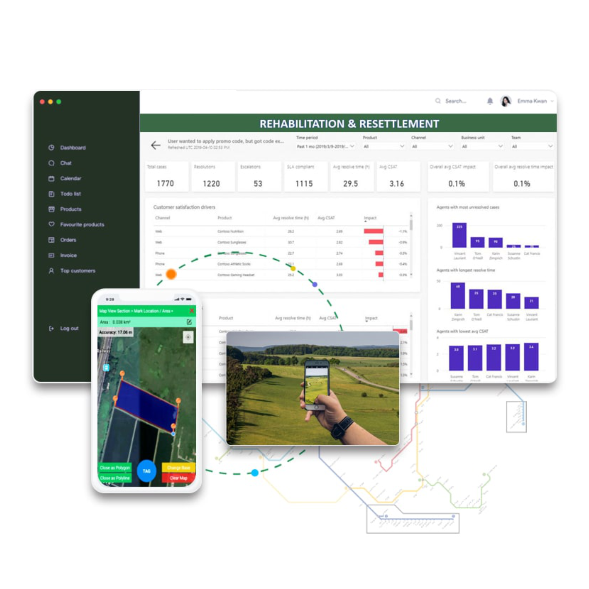
Location Analytics
Discover cutting-edge tools to optimise land mapping and management with the LAMS Module, designed to simplify operations and support smarter decision-making for government agencies, urban planners, and civil engineers.
Manage Multi-Location Land Seamlessly
Interactive Plot Maps with Key Insights
Thematic Colour-Coded Maps
Resettlement Colony Mapping
Satellite Imagery Integration
Detect Changes and Encroachments with Ease
Offline Mobile App for Remote Areas
DataAnalytics
Effortlessly streamline land management tasks with LAMS, a feature-rich software designed to simplify complex processes from start to finish. Here's how LAMS empowers users:
Track Land Allotment & Acquisition with Precision
Efficient Legal & Dispute Management
Comprehensive Land Ownership Management
Track Land Allotment & Acquisition with Precision
Efficient Legal & Dispute Management
Advanced Plot Value Estimation
Benefits
- LAMS builds a transparent and accountable mechanism for land provision
- It simplified with effective land management with the right ownership system for an efficient market environment
- An integrated land management system streamlines the land information for good governance
- This system has centralized data management repository where it saves complete data.
- It enables to Integrate multiple individual land management systems
- LAMS helps in enabling land development and management bureau offices for easy sharing of data by using a common database and web portal platform.

Web and mobile-based business solution
- Plot Map Visualisation
- Land Acquisition process Monitoring
- Owner & Family Tree Analysis
- Plot and Asset Valuation
- Encroachment Detection
- Legal & Litigation tracking
Location Analytics
- Land Mapping & Management of multilocational land across units.
- Visualise plot-wise map with Administrative boundaries, Waterbody, Habitation, Road & Railway, etc.
- Thematic color coded maps based on land type, allotment & acquisition status etc.
- Satellite images/ Google/ Bing Map integrated on a background as base imagery.



Features
User Journey of application
- Centralized Database A centralized database stores all relevant data pertaining to land parcels, including ownership records, land titles, surveys, and historical transactions.
- Data Standardization: Ensures consistency and integrity of data by adhering to standardized formats and data models for easy retrieval and analysis.
- Version Control: Tracks revisions and updates to land-related data to maintain an audit trail and ensure data accuracy.
- Regulatory Compliance Tracking: Track compliance with local, state, and federal regulations, including environmental laws, zoning ordinances, and land use regulations.
- Audit Trails: Maintain detailed audit trails documenting regulatory compliance activities, approvals, and mitigation measures implemented throughout the land acquisition process.
- Automated Reporting: Generate compliance reports and documentation required for regulatory approvals, environmental impact assessments, and public hearings.
This repository is used for documentation, and management and saves all land documents digitally.
- Budget Tracking: Monitor and track expenses related to land acquisition projects, including acquisition costs, legal fees, appraisal expenses, and compensation payments.
- Cost Estimation: Use historical data and cost estimation models to forecast expenses accurately and allocate budgets for land acquisition activities.
- Document Repository: A centralized repository stores all relevant documents related to land acquisition, organized by categories such as legal documents, surveys, permits, and contracts.
- Document Versioning: Track document revisions and maintain a history of changes to ensure access to the latest versions and compliance with document control procedures.
- Search and Retrieval: Powerful search capabilities enable users to quickly locate and retrieve documents based on keywords, metadata, or custom filters.
- Customizable Reports: Generate customizable reports and dashboards to analyze key metrics, trends, and performance indicators related to land acquisition projects.
- Data Visualization: Visualize data using charts, graphs, and maps to identify patterns, outliers, and areas requiring attention.
- Predictive Analytics: Utilize predictive analytics models to forecast land availability, market trends, and potential risks, enabling proactive decision-making and risk management.
Other CRM Modules
/LAMS
• Land Bank
• Land Acquisition
• Transfer of Development Rights (TDR)
/Project Monitoring System
Project Monitoring System offers a robust solution for managing large scale projects by providing tools for creating and maintaining project records
/eTendering System
Secure, Interactive, and Transparent Tender Lifecycle Management
/Grievance Management
streamlines complaint and feedback collection, improving government responsiveness and enhancing accountability
/Smart City Solutions
for Enhancing citizen experience and service ease
/CSR Monitoring System
Plan, manage and monitor all CSR activities easily.
/HRM
Enhanced recruitment processes
Effective people management
Optimised workforce productivity
Higher employee retention
/Inventory Management System
Innobles strengthens inbound tourism by providing innovative solutions that enhance the travel, tourism, and hospitality sectors
global offices
As a partner of corporates, Liquid has more than 9,000 offices of all sizes and all potential of session.
Paris
290 Maryam Sprins 260,
Courbevoie, Paris, France
+47 213 5941 295
Tokyo
37 Valentin Rapids Apt.
Tokyo, Japan
+17 113 6946 36
London
82 Bernie Greens Apt.
London, UK
+36 213 5941 295
New York
21 Valentin Rapids Apt. New Jersey, NYC
+47 213 5941 295
